By Linda Schmid
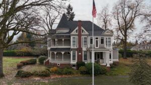
For years roofers have been backing away from ladders and chalk when it comes to roofing inspection. It only makes sense … it’s dangerous, particularly in post-catastrophe situations, and it’s time-consuming. Satellite imagery made many of these inspections unnecessary and aerial imagery (imagery captured from an airplane) was often an even better picture of what was going on up on the roof. Further, the software bases measurements and data on algorithms which makes assessments more consistent than information gathered by people. In the end, this method saves time and money for everyone.
Until recently, aerial imagery is what the majority of roofers and builders used according to Piers Dormeyer, Commercial Group President at EagleView. EagleView Premium Roof Report is the product that has been popular in the industry for the past 12 years, he says.
“We fly airplanes in grids over the landscape. It’s like mowing the sky,” he said.
They have a fleet of aircraft capturing data from about 90% of the land mass. Some low-population areas are not covered.
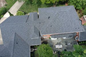
The imagery they collect is very informative; it’s like Google Earth with very high resolution. Not only can you see the roof and its condition, you can see the whole property, other structures, how close the neighbors are, trees that may be in the way, and anything else that may affect access. Tens of thousands of industry professionals use this technology to gather information for roofing estimates.
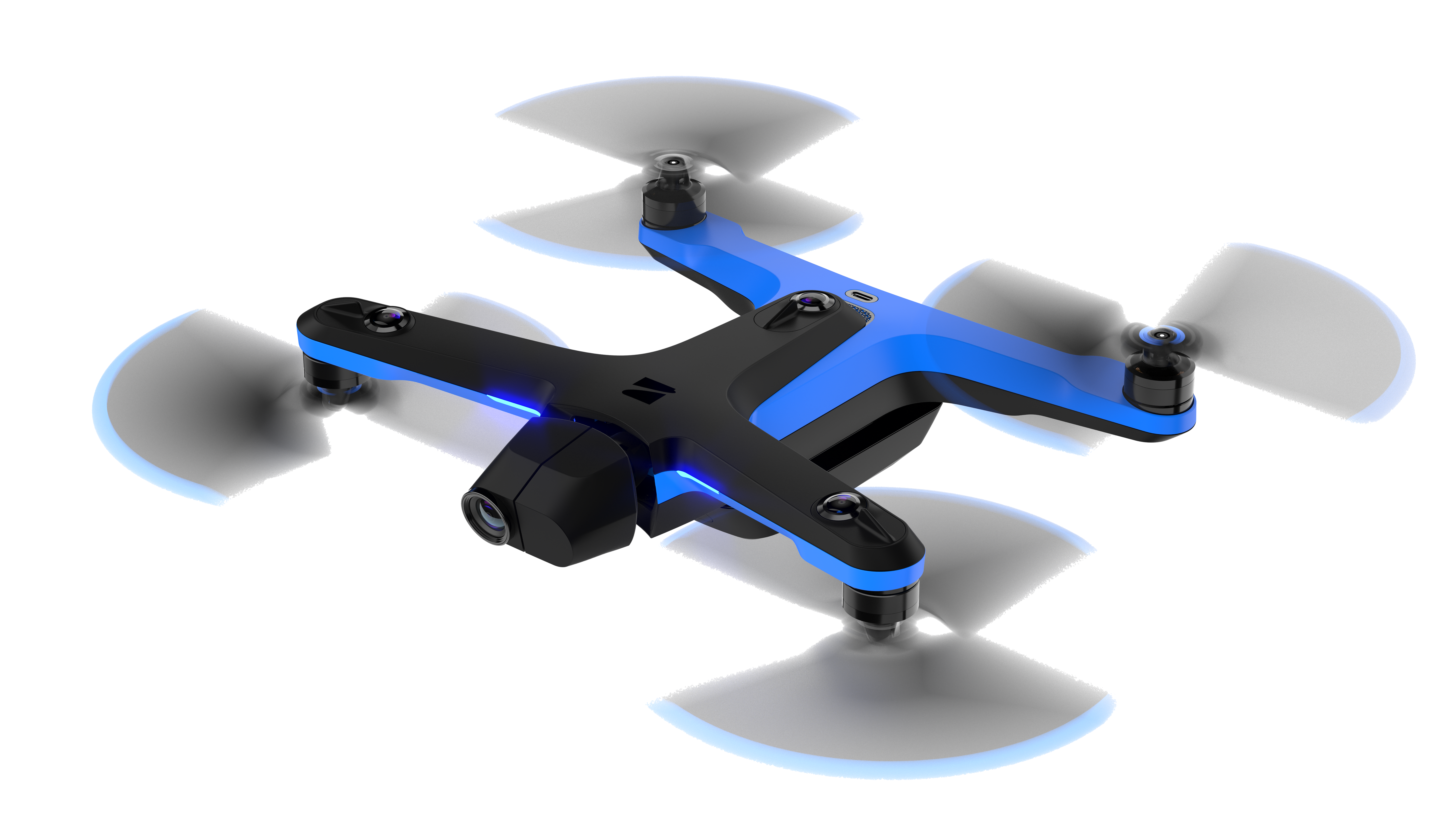
EagleView Assess Drones
Recently EagleView has begun tapping into drone technology. Their new product, Assess, has three basic uses:
1. Viewing specific details up close. When photographing up close for details, for example to check out a piece of flashing, the drone will hover a couple feet over the roof.
2. Basic house quotes in rural areas where aerial imagery is unavailable. This provides detailed measurements for quotes.
3. Damage scopes. These are often used for insurance purposes. The data goes into the Cloud and gets “crunched” using AI technology.
The insurance industry has been using this new product since its launch in spring of 2021, and this past summer EagleView teamed up with approximately 40 roofing companies to test the product for their purposes. As a result, there are hundreds of orders waiting to be deployed.
How It Works
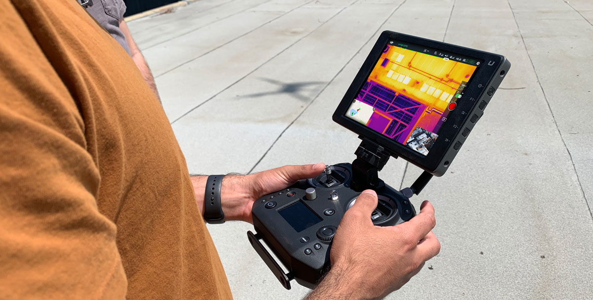
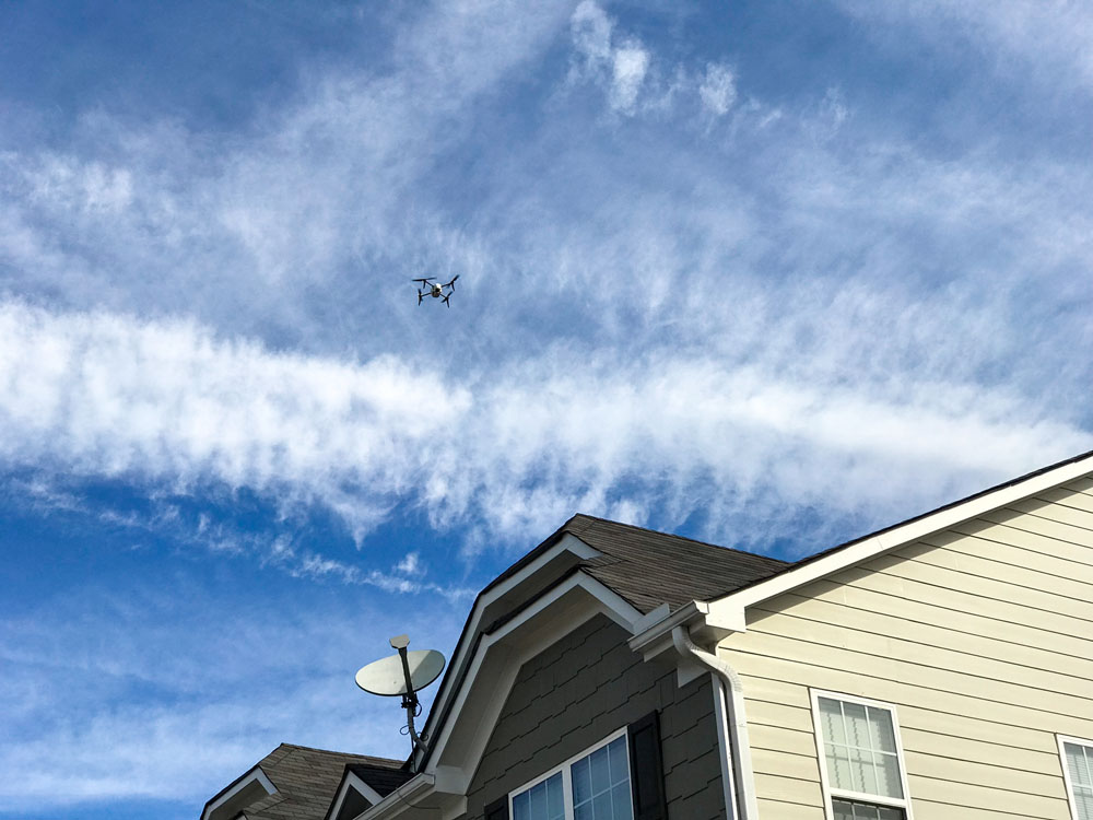
When an inspection has been requested, a pilot has to be assigned to it. The pilot is required to have the FAA code, part 107 certification to fly the drone; size aside, a drone is an aircraft after all.
The pilot drives to the site and launches the drone up to 60 or 80 feet above the site. Through the included i-pad the pilot draws a box around the property thereby confining the drone to that space, a necessary precaution so that the drone does not invade the neighbors’ property. The drone will then proceed to “mow the sky” just like a plane taking aerial photography. The pilot can take over the manual manipulation of the drone if they want to go back for more detail or they require a different angle.
The imagery is then developed into a basic roof report with imagery and line diagrams. Companies develop proposals from this report, usually through their own software, but integrations for third party software are available for those who need it.
Damage Report
The report will show roof damage. For example, if there has been a hail incident, all of the places where hail damaged the roof will be marked. They are all circled and neatly shown, and no one had to spend hours up on the roof with chalk marking them off.
Challenges
When asked, ‘What challenges have you had to overcome with this product?’ Dormeyer chuckled.
“We are never done overcoming challenges.” Dormeyer elaborated, “Technology is what we do, so we are pretty strong on that aspect of the business. For us, a challenge has been understanding the technology from the perspective of the customer who suddenly has this piece of technology in his hands and doesn’t understand how to set it up or how to use it.”
The company gets a lot of questions about how to connect the drone to the i-pad, how long the battery will last and concerns of that nature … things that the company as a technologically advanced group had taken for granted. It is a learning experience for them.
They are constantly striving to improve usability for their customers as well as the work flow of the application, and even helping their customers get their FAA part 107 certification.
“It’s a simple thing, but it is one more thing for a client to have to do. We help by hosting certifying events across the country. We bring them in, educate them, feed them, and get them ready to go,” Dormeyer said.
Feedback
EagleView has had very positive responses from users; it makes their work easier. One thing Dormeyer hears often is that estimates roofers have had rejected by some insurance companies have been accepted once the roofer used Assess. Of course, this may not be everyone’s experience in this situation, but in some cases perhaps the insurance company has used Assess or they see it as a neutral source of information. Either way, it has resolved conflict for some groups allowing the process to run more smoothly.
When drones were brand new to the general population, you might have seen an angry neighbor try to bring one down with a BB gun, but that’s not so today. More than anything, neighbors — kids and adults alike — will gather around to watch the drone at work and ask the pilot all kinds of questions. Dormeyer says it ends up being great marketing for the roofer and EagleView too.
Where Next?
Technology moves quickly these days and EagleView is an innovation company, so unsurprisingly, there is a lot on the horizon. They are upgrading their software continuously and working on higher resolution capture. They’re also developing EagleView Cloud software which is effectively a new platform that allows the contractor to view and access the most up-to-date imagery available. Included tools provide measurements and allow them to see changes over time, zeroing in on the building and split screens to compare views now with views from five years ago.
Use of the UAV (unmanned aerial vehicle) drone category in commercial markets and solar markets is expanding as well … it seems that the sky really is the limit. l